Las Vegas 2026 · Where to stay
Where to stay for Las Vegas 2026
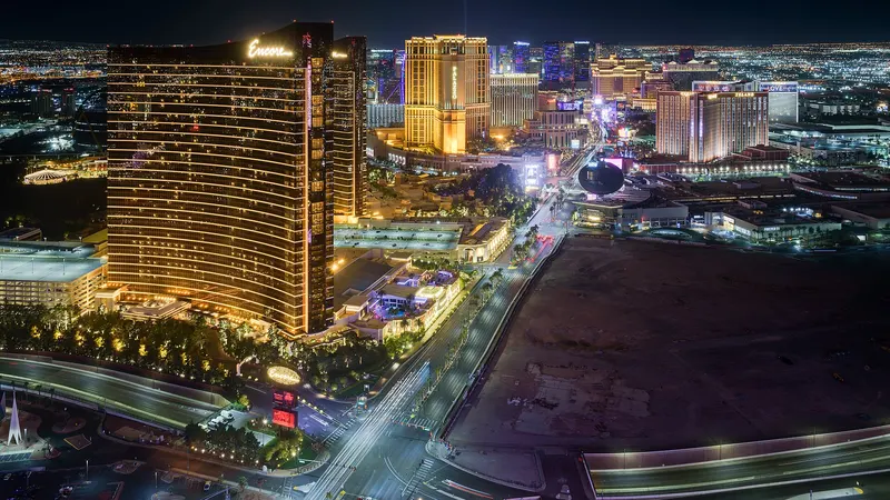
The track runs on the Strip itself, plus Harmon Ave, Koval Ln and Sands Ave. Many big resorts sit right on it, so the question is less "how close" and more "which side of the barriers, and how do I get out after the race".1,2
Quick answer
Pick a hotel on the track or near a monorail station. The organizer offers no event parking and recommends walking.1
Updated Nov 1, 2026 · Facts checked against the cited sources on Nov 1, 2026
The short version
Walk or ride the monorail; don't plan on driving
The organizer offers no event parking and encourages walking from nearby hotels, with rideshare points at Virgin Hotels, the Hughes Center, Tuscany and Park MGM.1
The monorail runs nonstop from Tuesday Nov 17 to early Monday Nov 23, and three of its stations sit inside the race area. A hotel near a station (SAHARA, Westgate, the Convention Center or MGM Grand) is a solid fallback.1,2
Staying on the track is convenient on foot but can mean detours by car while the track roads are closed.1 See road closures.
| # | Area | walk km | walk mi | road km |
|---|---|---|---|---|
| 01 | Tuscany SuitesEast of the track · One of the four organizer rideshare points.1 | 1.1 km | 0.7 mi | 1.7 km |
| 02 | Planet HollywoodOn the track · The track runs past it on the Strip.2 | 1.4 km | 0.9 mi | 1.4 km |
| 03 | The LINQOn the track · Harrah's/The LINQ monorail station is one of three inside the race area.2 | 1.6 km | 1.0 mi | 1.6 km |
| 04 | MGM GrandSouth Strip · MGM Grand monorail station: board northbound into the race area.2 | 1.6 km | 1.0 mi | 1.6 km |
| 05 | The CosmopolitanOn the track · The track runs past it on the Strip.2 | 1.7 km | 1.1 mi | 1.8 km |
| 06 | Virgin HotelsEast of the track · One of the four organizer rideshare points.1 | 1.7 km | 1.1 mi | 1.9 km |
| 07 | The VenetianOn the track · Home of the Velocity Club viewing zone on the Strip.2 | 1.9 km | 1.2 mi | 2.6 km |
| 08 | Park MGMSouth Strip · One of the four organizer rideshare points.1 | 2.0 km | 1.2 mi | 2.1 km |
| 09 | Caesars PalaceOn the track · Flamingo/Caesars Palace monorail station is inside the race area.2 | 2.5 km | 1.5 mi | 2.4 km |
| 10 | BellagioOn the track · Bellagio Fountain Club North and South zones overlook the track.2 | 2.6 km | 1.6 mi | 3.1 km |
| 11 | Wynn / EncoreOn the track · On Sands Ave the cars pass the Wynn and Encore.2 | 2.7 km | 1.7 mi | 2.8 km |
| 12 | Mandalay BaySouth Strip · No monorail station listed nearby.2 | 3.3 km | 2.0 mi | 3.3 km |
| 13 | Resorts WorldNorth Strip · Take a southbound monorail from Westgate or SAHARA.2 | 3.3 km | 2.1 mi | 4.8 km |
| 14 | Convention Center areaEast · Boingo Station at the LVCC: southbound into the race area.2 | 3.3 km | 2.1 mi | 4.4 km |
| 15 | FontainebleauNorth Strip · Westgate or SAHARA stations for the monorail.2 | 4.0 km | 2.5 mi | 4.0 km |
| 16 | SAHARANorth Strip · SAHARA Las Vegas Station: southbound into the race area.2 | 4.5 km | 2.8 mi | 4.8 km |
| 17 | Downtown (Circa, Fremont St)Downtown · Far from the track; the Neon City Festival runs here Nov 20–22.3 | 7.9 km | 4.9 mi | 11.0 km |
Book
Search the race-weekend dates
Links open with check-in Nov 18 and check-out Nov 22, 2026.
More for race week
Newsletter
Las Vegas 2026: changes before race week
One email if the organizer, RTC or Clark County change closures, gates or the schedule. Nothing else.
We store only your email and the list you chose. See privacy.
Sources
- f1lasvegasgp.com (race organizer): A–Z guide (gates, bags, re-entry, rideshare, monorail, road closures), 2026 (checked Nov 1, 2026)
- Las Vegas Monorail: F1 Las Vegas Grand Prix: monorail service, stations and zones (2026) (checked Nov 1, 2026)
- Neon City Festival / Downtown Las Vegas: Neon City Festival returns Nov 20–22 (2026) (checked Nov 1, 2026)
- OpenStreetMap contributors / FOSSGIS routing: Walking distance computed with OSRM (foot profile) on OpenStreetMap data, normal street network without race barriers, geocoded with Nominatim (checked Nov 1, 2026)
- OpenStreetMap contributors / Project OSRM: Driving distance computed with OSRM on OpenStreetMap data (free-flow road network, no event traffic), geocoded with Nominatim (checked Oct 25, 2026)